blah blah blah
Giant Falls
Length: 3.0 miles out-and-backDifficulty (click for info): Easy
Elevation Gain: 830 feet (+100 feet on return)
Rating (click for info): 6/10
Height: 200'
River: Peabody Brook
Driving Directions:
Trailhead is on North Road in Shelburne, NH. Traveling east from Gorham, North Road leaves the north side of Rt. 2 3.4 miles east of where Rt. 16 turns south. North Road crosses the Androscoggin River and swings right on the other side. At 1.3 miles from Rt. 2, there is a small dirt pull-off on the right side of the road and an AMC sign at the gated path on the other. It is just before a stone house on the left. Click here for a Google map.
About the Hike:
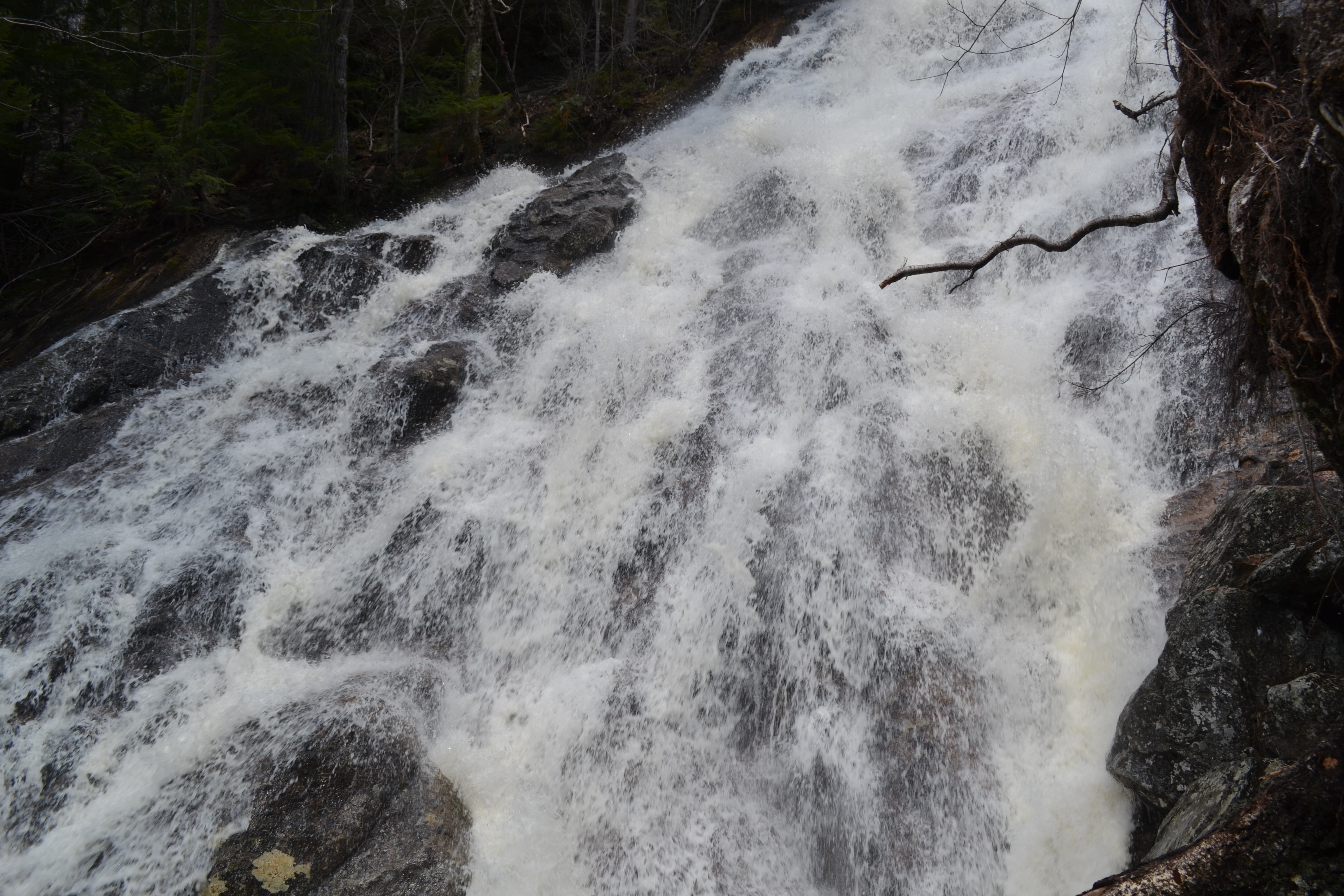
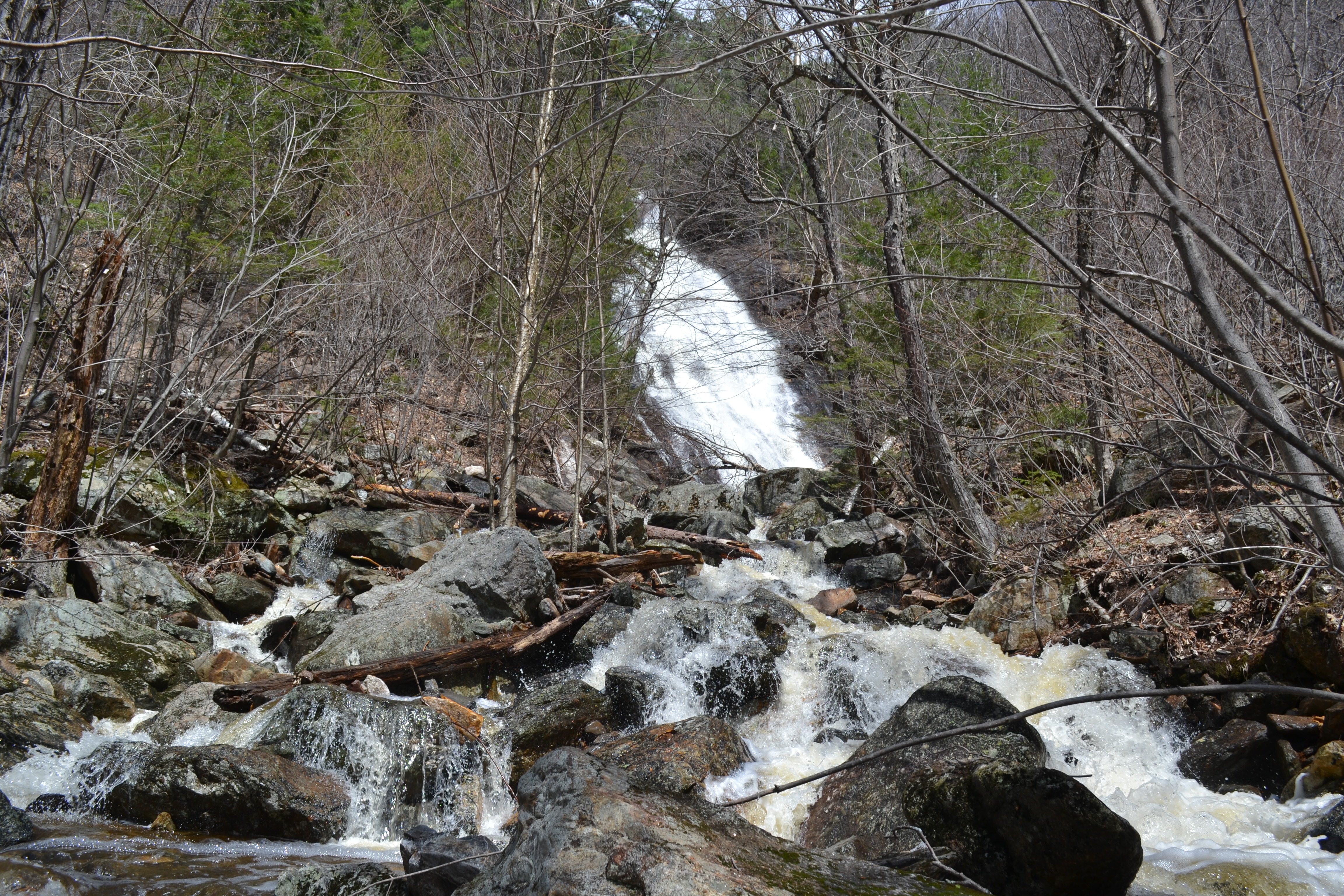
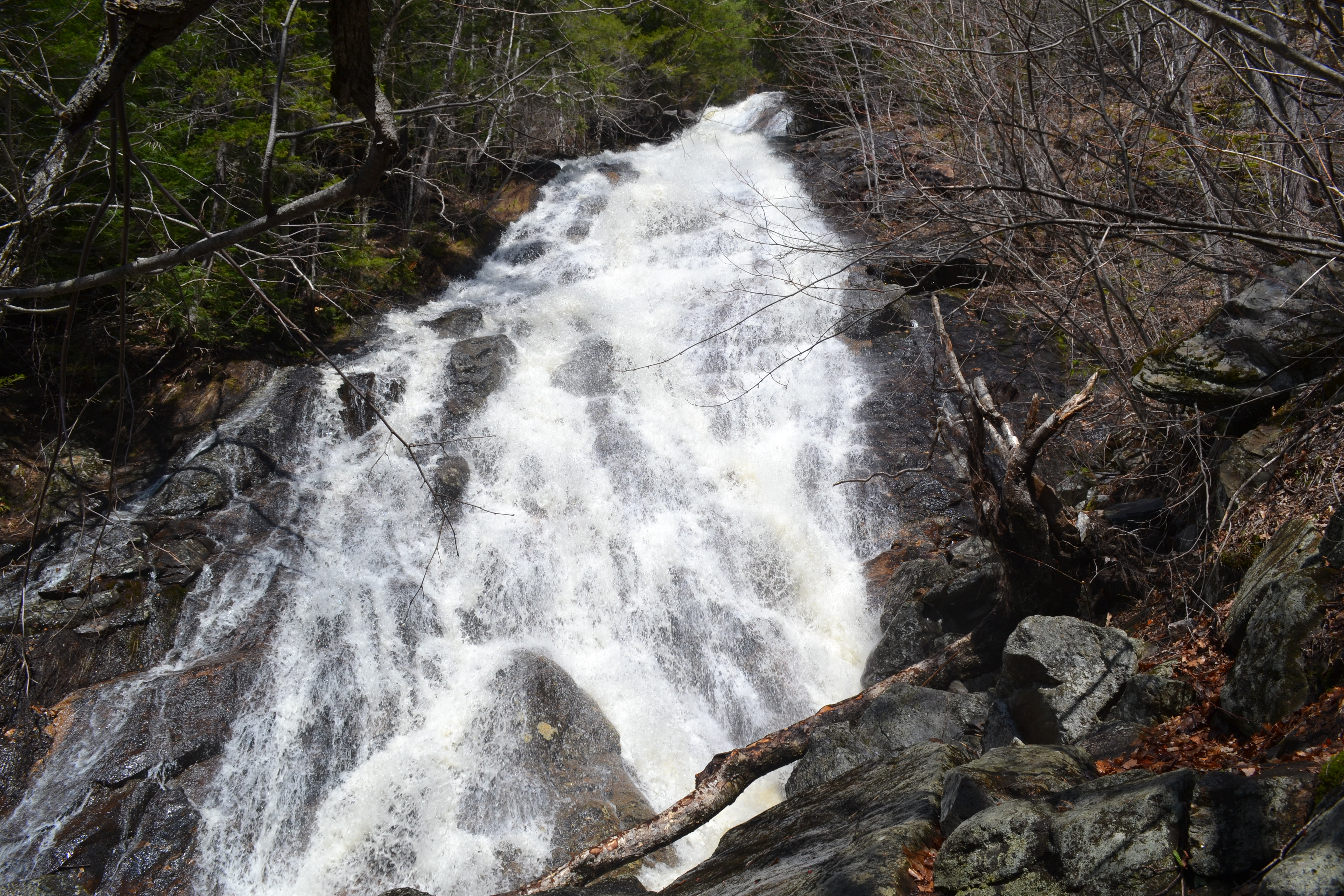
A shadowy ravine on the south side of the rugged Mahoosuc Range conceals Giant Falls, a dual-natured waterfall - in early spring, visitors are treated to a majestic, voluminous torrent careening down an awe-inspiring cliff. But in late summer, when water is low, all that's left is the cliff. This factor seems to be what keeps it from mass popularity on the level of other waterfalls its size. But if you catch it at just the right time, you'll discover a worthy natural wonder rivalling the likes of White Mountains tourist stops such as Arethusa and Ripley Falls. Another peculiar factor about the waterfall is that only half of its monumental stature can be clearly observed at one time. From the end of the trail at the bottom of the falls, what can be seen is only the lower portion of the two-tiered waterfall. But even this can be one of the most incredible falls you'll see in New Hampshire!
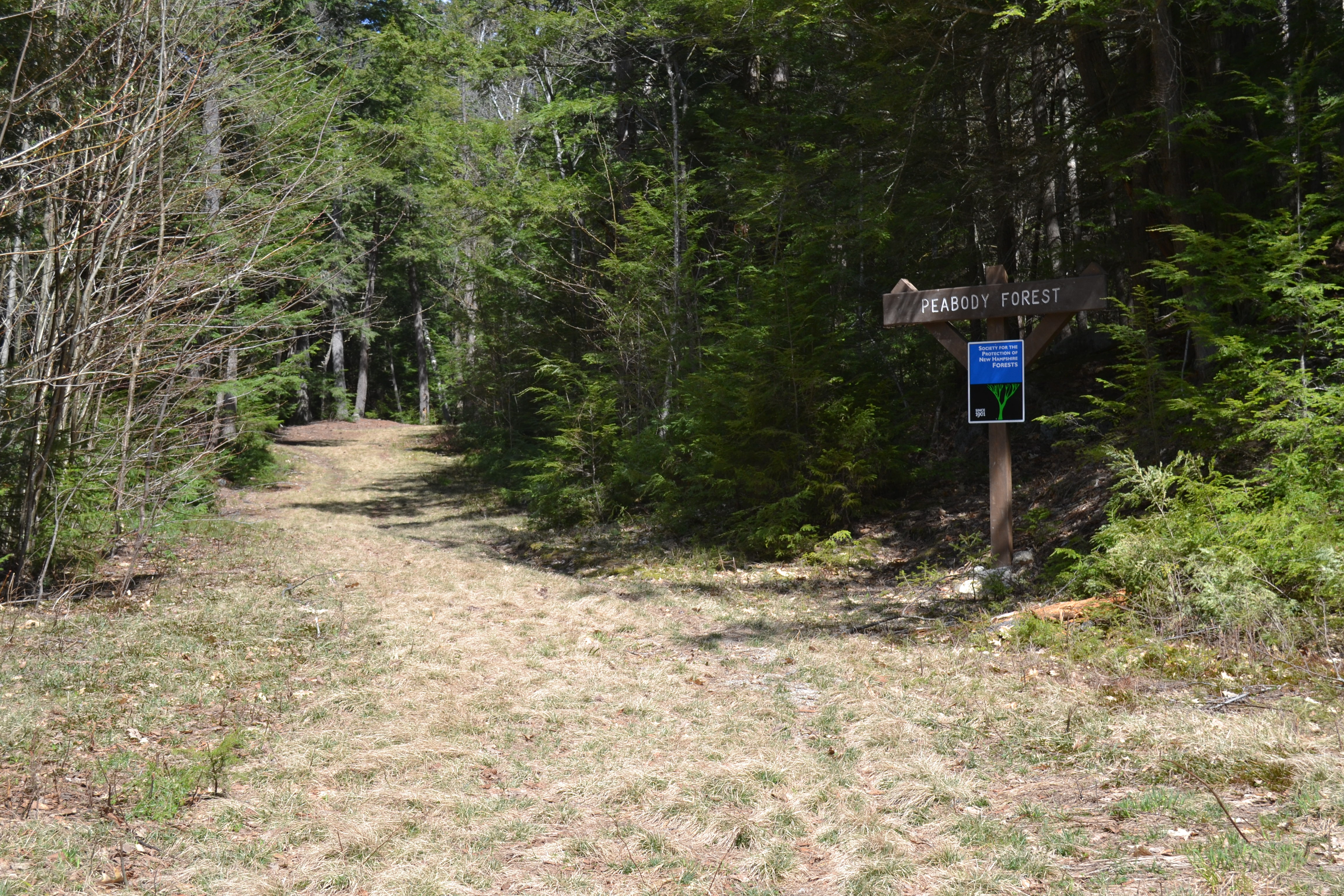
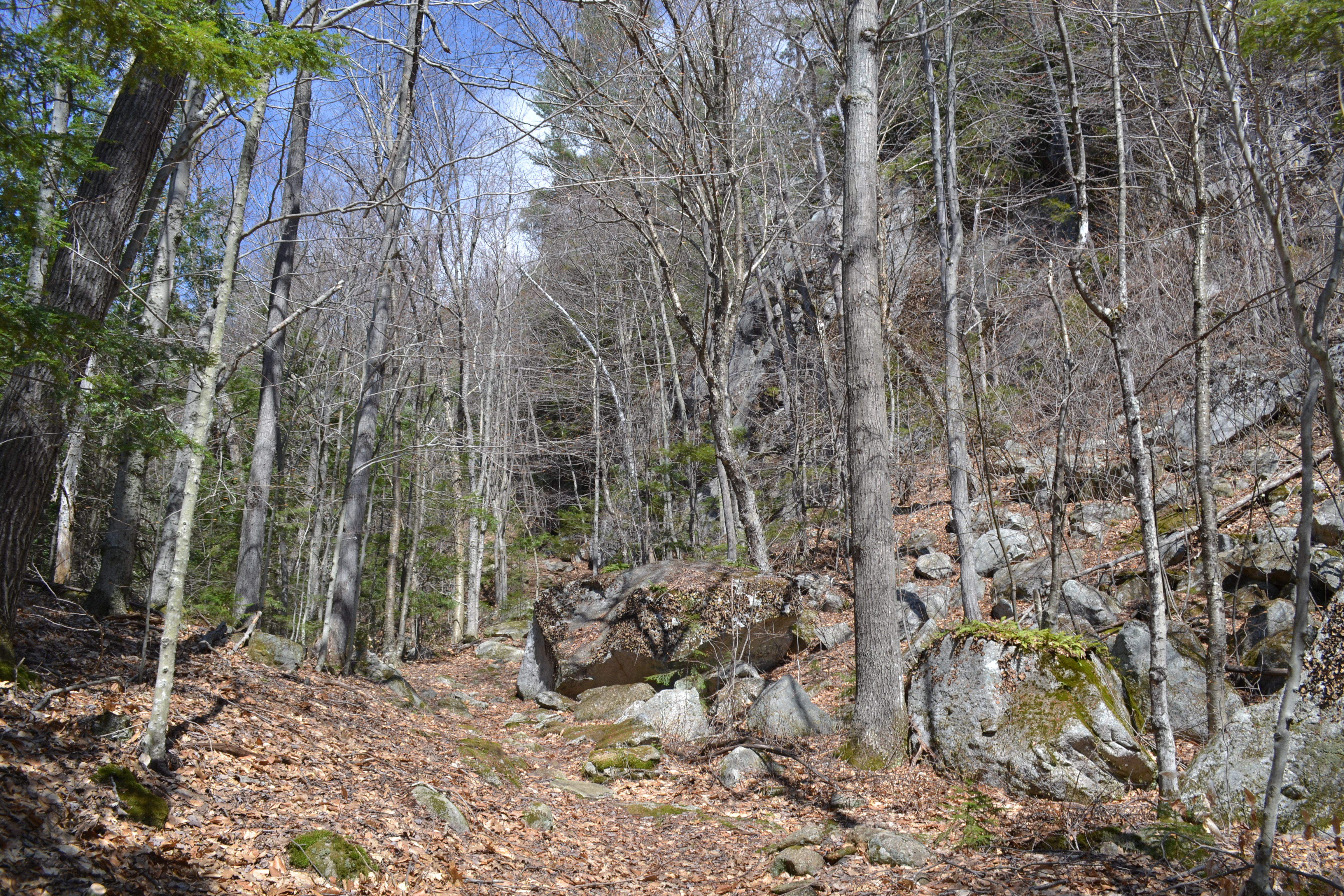
Cross the road and begin hiking on the Peabody Brook Trail, which follows a logging road most of the way. After 0.1 miles on an initially rough and eroded section, the trail joins a drive coming from a nearby house (watch for the right turn on the way back) and then bears right onto a more pleasant grassy path. Crossing a wooden bridge over Peabody Brook, the trail swings left and passes a Forest Society signpost marking the Peabody Forest. Now beginning the stroll along the old logging road, you are acquainted with the rushing water on its journey down from the waterfall. If it is racing, you are in for an absolute delight. After 0.3 miles, pass a regenerating logged clearing on the right. In another 0.4 miles, bear left to stay on the trail where Middle Mountain Trail follows another logging road off to the right. Just past this, the road dwindles into an average forest path. Not long after, the trail passes below some sizeable cliffs, climbing over the rocky terrain at the base and winding to the right around the hillside. The climb sharpens as you contour across the southwestern slopes of Bald Cap Peak.
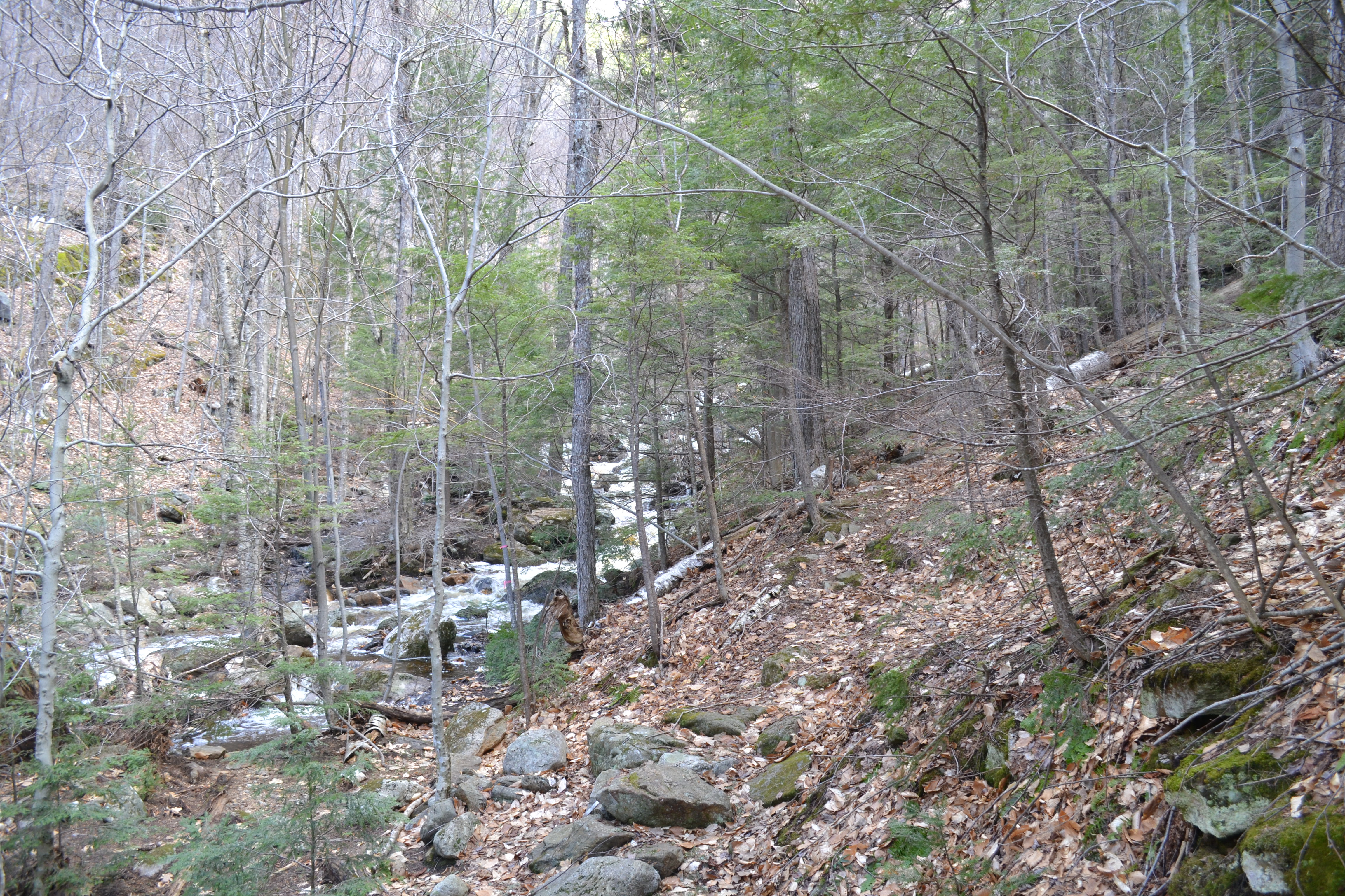
In 0.4 miles from the junction with Middle Mountain Trail, a spur shoots off downhill, and the main trail continues up. Turn left onto the spur, marked by a sign for Giant Falls. The path descends quickly back to the brook. If you are visiting in the springtime, as recommended, shift your gaze upward through the trees (you can see when there aren't any leaves) to understand the sheer size of the waterfall. You should be able to see the upper portion of Giant Falls, entirely above the drop you will investigate up close. As the trail intersects the brook and proceeds to follow it upstream, you will pass by many smaller cascades below the waterfall. The path undulates for a few tenths of a mile along the brook side. At its termination, the trail allows you to walk right up to the base of the waterfall, where during low water, you will approach only a dripping cliff. In its optimal season during snow melt, you will stand in awe in the mist of the thundering torrent. As you observe the crashing flood spread over the massive cliff, consider that there is another waterfall of nearly similar size that lies just out of sight above the top of this one!
Printable directions page